Kongsberg Geospatial, partners to use AI and UAS to improve search and rescue ops in Canada
May 26, 2020 | AUVSI News
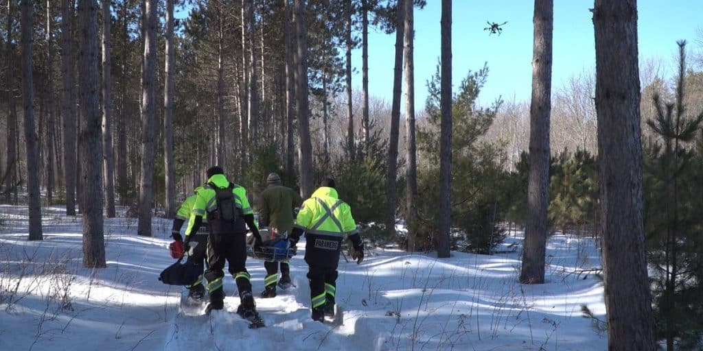
Public Safety Canada has selected Kongsberg Geospatial, Larus Technologies, and the Civil Air Search and Rescue Association of Canada (CASARA) to help develop new methods for using drones in search and rescue operations in remote communities in Canada using geospatial software, artificial intelligence, and machine vision software.
Dubbed OVERSEE—an acronym for Optical Vision Enhancement and Refinement of Sensor Exploitation Effectiveness—the project will seek to address the unique challenges of conducting search and rescue operations using UAS platforms in remote areas such as indigenous communities in the Arctic and their immediate surrounding area.
“We and our partners believe that this project can help search and rescue volunteers save lives in isolated communities by using inexpensive, off-the-shelf drones to conduct searches until the Canadian Air Force or other aeronautical assets can join the search,” says Kongsberg Geospatial president, Ranald McGillis.
“We also hope to increase survival rates by showcasing how drone systems can be augmented with Computer Vision systems for improved performance.”
To start, OVERSEE will use available search and rescue statistics from various agencies including the Department of National Defence, CASARA, Transport Canada. Simulations driven by artificial intelligence will be executed, and using deep learning techniques, the AI will investigate how BVLOS regulation effects SAR efforts that make use of drones, and how drones have been integrated most effectively in search and rescue operations, particularly for isolated indigenous communities in Canada’s North that don’t have quick access to Aeronautical search and rescue assets.
The ultimate goal of the research is to help CASARA members and Ground Search and Rescue (GSAR) workers use BVLOS drones more effectively in search and rescue operations.
As the leader of the project, Kongsberg Geospatial will bring its expertise in precision mapping, Air Traffic Management, and the development of multi-vehicle UAS control stations for BVLOS missions to the table to help develop tools and procedures for the safe, effective use of drones for search and rescue missions in remote areas. The company will also contribute tools and training for machine vision techniques.
A specialist in Intelligence Surveillance and Reconnaissance (ISR) systems for defense applications, Larus Technologies will contribute its Total::Perception simulation engine and Total::Vision computer vision technology to the project.
Meanwhile, CASARA, in collaboration with its volunteers, will help collect drone video from training exercises throughout Canada, as well as search and rescue event statistics from community organizations. Once the project is complete, CASARA membership will help circulate the SOPs derived from the project to their membership of Civil Air Search and Rescue workers and volunteers across Canada to make sure that everyone has access to the improved UAS SAR guidance.
The project is primarily funded through Public Safety Canada’s SARNIF fund, but all three partners will be making in-kind contributions in software licenses, technology, and professional services.
- Industry News